Empowering the future through our innovative solutions.
We strategically align with the global imperative of energy transition, climate change mitigation, sustainability, and achieving net-zero objectives.
Our country mapping solutions, encompasses groundbreaking offerings across new renewable energies, critical raw materials, water management, environmental stewardship, and biodiversity preservation. Together, we pave the way for a sustainable and resilient future.
We quantify the natural capital of the country, comprised of surface and subsurface resources.
SUBSURFACE

Our innovative technologies allow for efficient target exploration through airborne data acquisition and analysis reducing environmental impact.
LCT Gravity & Magnetics Software
Xcalibur Smart Mapping specializes in gravity and magnetics data processing, interpretation, and management. Their LCT software suite creates models of the earth subsurface, performs forward modeling and joint inversion constrained by various data sources.
The software is designed for large petroleum companies and research institutions, offering a complete package for gravity and magnetic modeling, interpretation, and data processing. They provide 2D and 3D modeling capabilities, grid filtering tools, magnetic depth estimation software, and interactive data processing systems.
With over 100 years of cumulative experience, Xcalibur Smart Mapping also offers consultancy services for survey design, data processing, integration, and interpretation. They utilize proprietary software to enhance results and offer value-added services.

LCT Gravity & Magnetics Software
Airborne Magnetics and Radiometrics (MagRad)
Airborne Electromagnetics (AEM)
Airborne Scalar Gravity (ASG)
Marine Gravity and Magnetics (GravMag)
Airborne Gravity Gradiometry (AGG) FALCON
GEOSPATIAL TECHNOLOGIES (GST)
We are leaders in the sector due to the size of our fleet, which allows us to undertake projects worldwide. We have both airplanes and helicopters to support our innovative technology.
Discover our fleet modified and patented by Xcalibur Smart Mapping, powered by cutting-edge solutions and technologies.

Air Tractor (502B, 504)

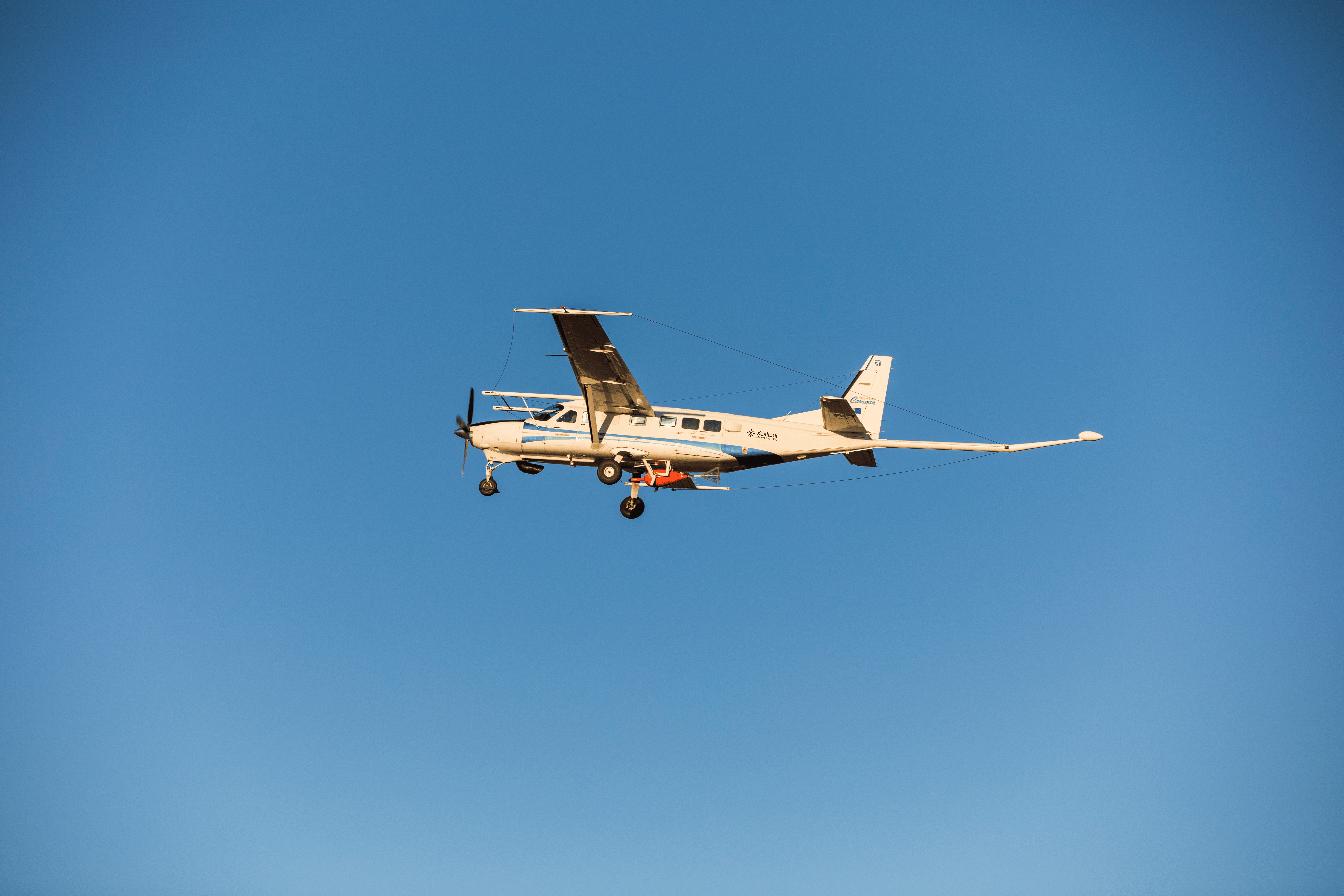
Cessna 208B Grand Caravan – Cessna 208B Supervan 900

PAC 750
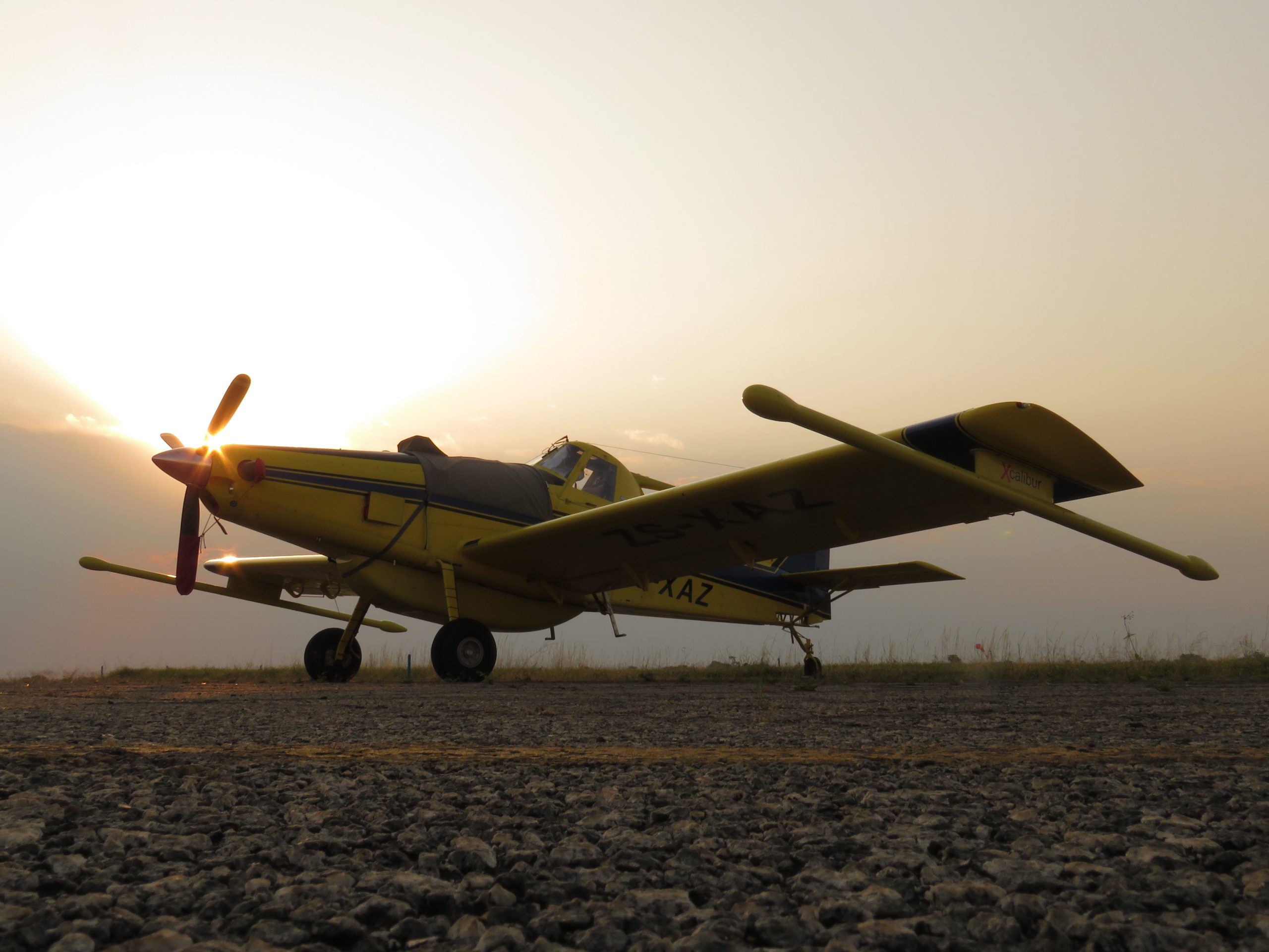
Air Tractor (502B, 504)
The Air Tractor is a versatile aircraft with several key features. It can operate in challenging environments such as short airstrips, salt pans, and farm roads, making it ideal for survey work. Its structurally efficient airframe reduces drag force, while the long fuselage enhances stability on the ground and in the air. The heavy-duty landing gear acts as a shock absorber during landings. The aircraft is optimized for low flying, resulting in improved data resolution. It also prioritizes pilot safety with the use of AMSAFE seatbelt airbags and a cockpit design inspired by Formula One race cars. With its cost-effective performance and excellent security capabilities, the Air Tractor stands out among survey aircraft options.